What We Do
Resource Monitoring
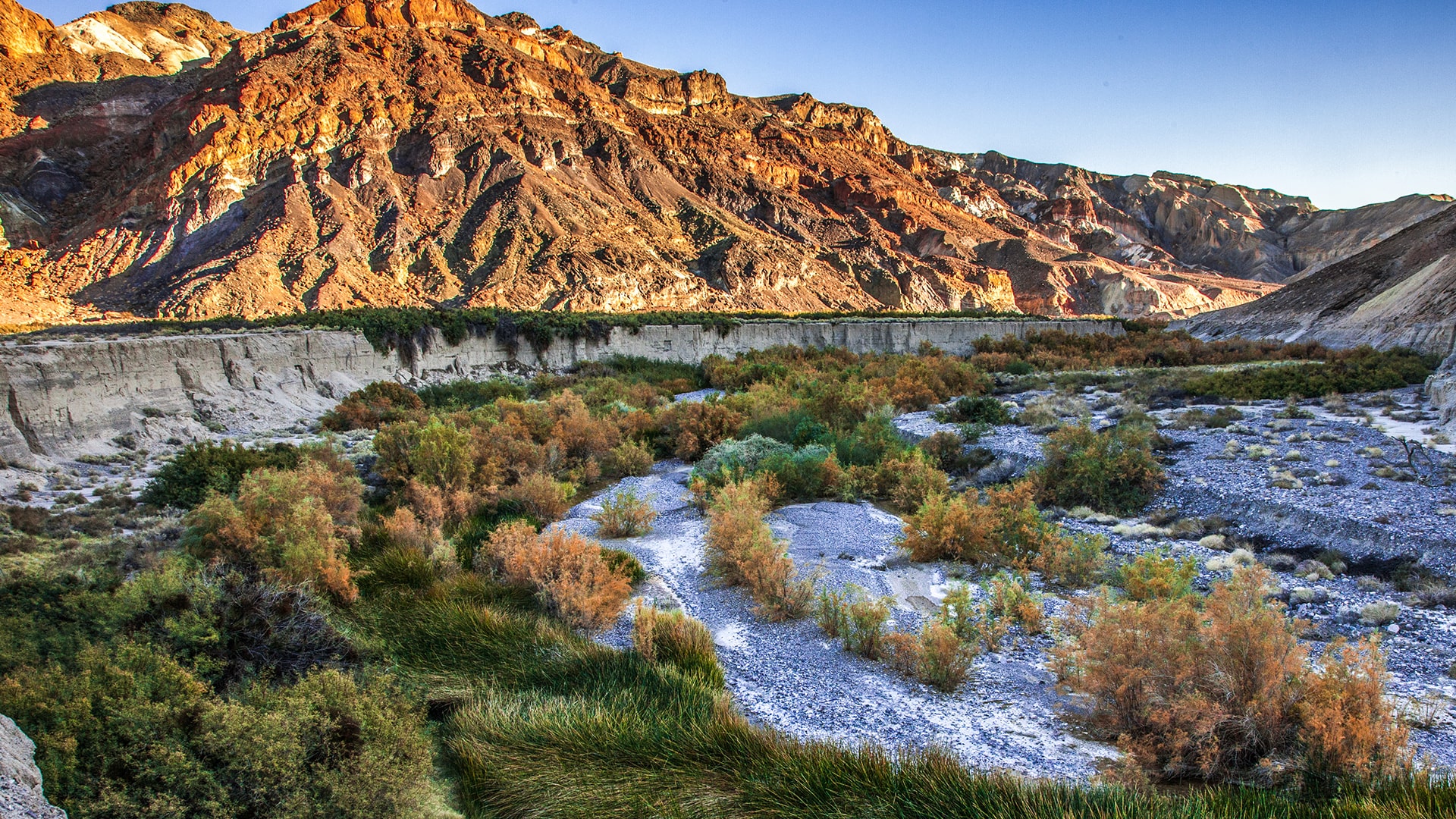
Borehole Spring, by Andy Zdon
We collect data on the Amargosa’s most unique and vulnerable resources.
The Amargosa Conservancy conducts regular scientific monitoring in our watershed to help gather knowledge and establish baseline data for the decision makers who manage our surrounding public lands.

We conduct periodic monitoring in the spectacular Kingston Mountain Range, reporting to the local BLM office about cattle populations, possible grazing problems, and vandalism and needed repairs to the simple facilities at the three public land springs in the range.
At Carson Slough, the outflow area for the Ash meadows National Wildlife Refuge, we conduct monthly groundwater elevation monitoring and plant health monitoring of the federally listed endangered Amargosa Niterwort.
This data is entered into the National Hydrologic Database and shared for public and scientific reference and research.


At the Tecopa Marsh, we conduct quarterly monitoring and report on the condition of bulrush habitat to the California Fish and Wildlife Service. This monitoring provides critical information for the study and protection of federally endangered Amargosa Voles that live in the wetland.
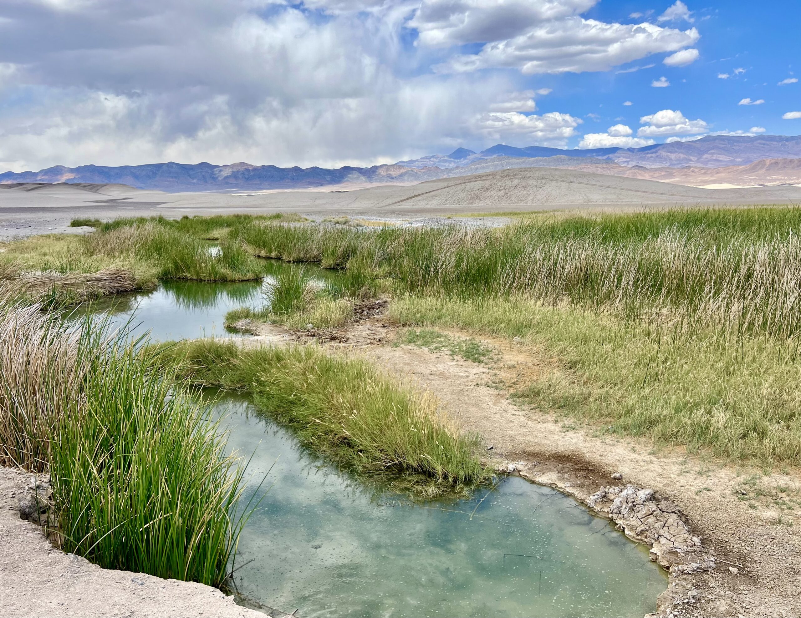
We conduct hydrologic monitoring at springs and groundwater wells throughout the Amargosa watershed. Water quality, water chemistry, and groundwater elevation data all provide critical information about the health of groundwater-dependent springs, as well as trends in groundwater levels throughout the basin.
Hydrologic monitoring data have been analyzed and interpreted in the State of the Basin reports.

From our blog: RESOURCE MONITORING
2026 Amargosa State of the Basin Report
This 2025 State of the Basin Report (SOBR) was prepared by Roux Associates, Inc. (Roux) on behalf of the American Bird Conservancy (ABC) as part of a much larger effort that is being conducted between ABC, the Amargosa Conservancy (AC), California Botanical Garden,...
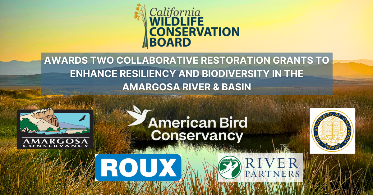
California Wildlife Conservation Board Awards Amargosa Restoration Projects
By Mason Voehl, Executive Director In a remarkable year for the Amargosa River and Basin, the California Wildlife Conservation Board (WCB) has awarded two critical grants to support the resilience and biodiversity of this unique desert ecosystem. These grants, one...
Champions of Science: USGS Publishes AC-Funded Study of Evapotranspiration in the Amargosa Basin
Science is and always will be a pillar of of the work our organization does to protect the Amargosa Basin. For the last 20 years, Amargosa Conservancy has worked alongside local governments, state and federal agencies, non-profit partners, and researchers to develop...
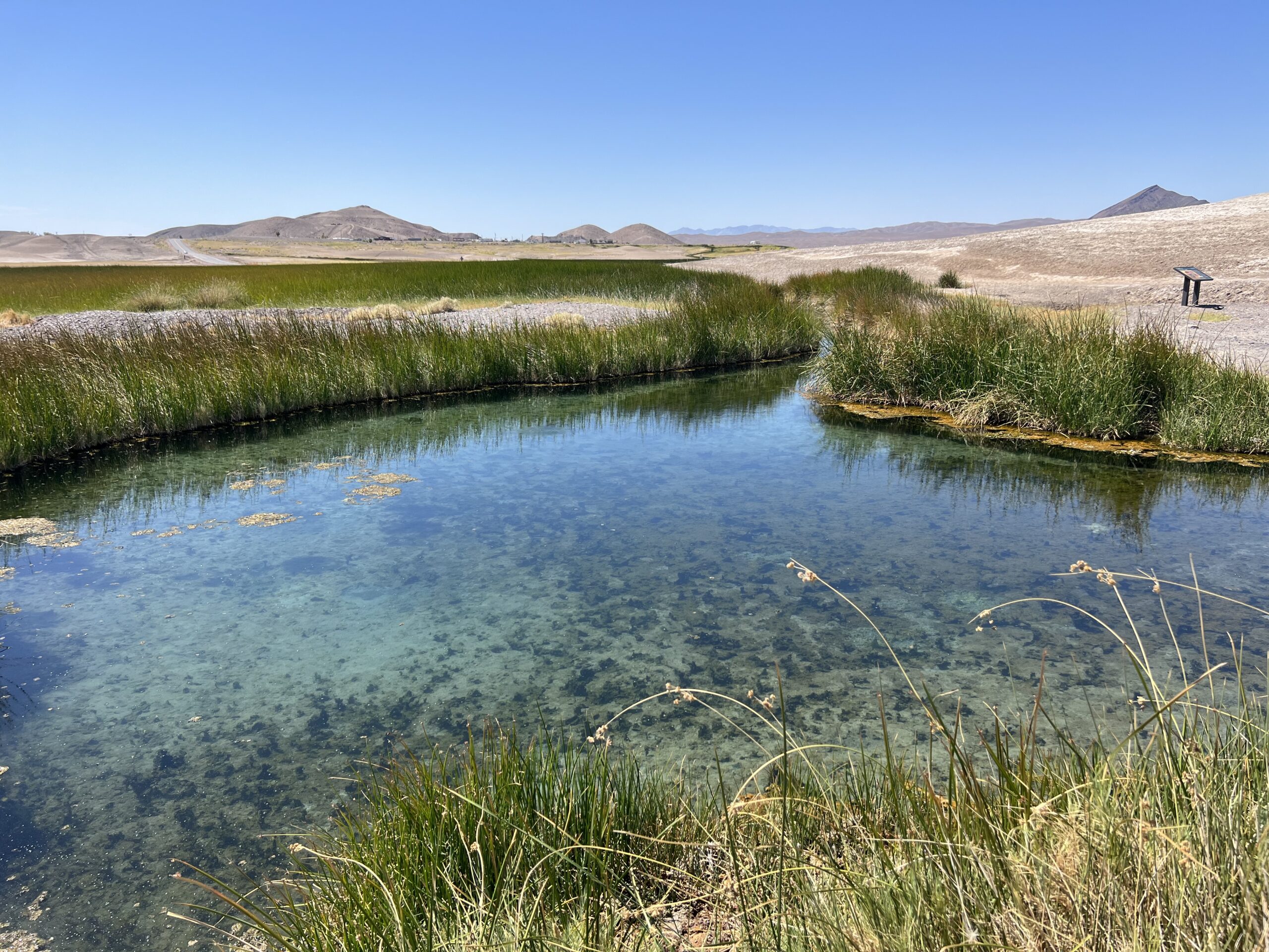
Amargosa Hydrology: Springs and Current Conditions, by Andy Zdon
Miss out on our 2023 Summer Seminar on Amargosa Hydrology? Watch the recording of Andy Zdon's presentation on the fascinating science and stories of the Amargosa Basin's springs: Love springs, and love the work we're doing to protect them in the Amargosa Basin? Become...
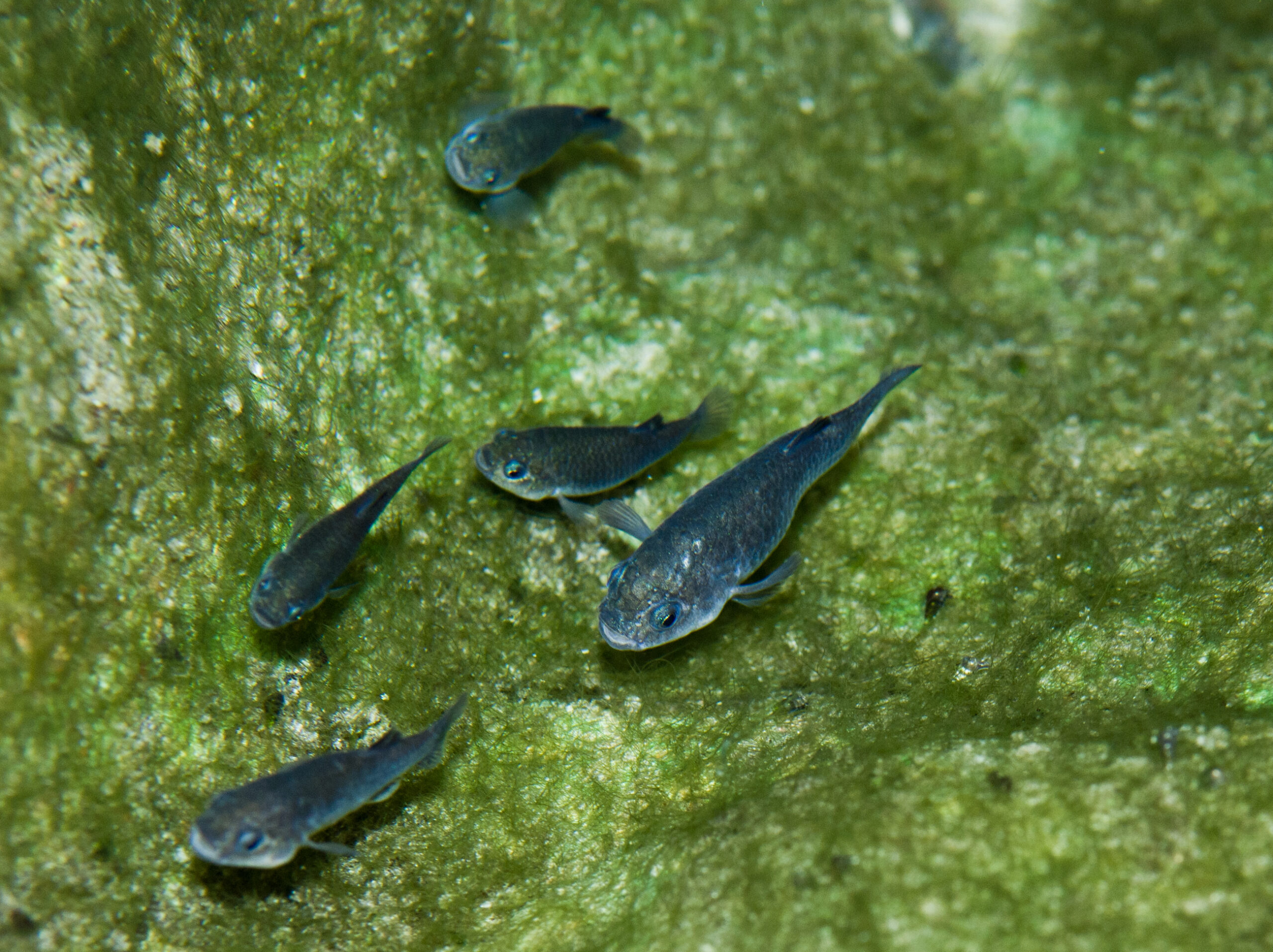
Fishes of the Amargosa Basin
By Patrick Donnelly Vice President, Amargosa Conservancy Great Basin Director, Center for Biological Diversity Before the Amargosa Basin was the hottest, driest place in North America, it was relatively moist. Abundant precipitation during the Pleistocene (as recently...
2020 Amargosa State of the Basin Report
This 2020 State of the Basin Report (SOBR) was prepared by Partner Engineering and Science, Inc. (Partner) on behalf of the Amargosa Conservancy (AC) as part of a much larger effort that is being conducted between AC, The Nature Conservancy (TNC), U.S. Bureau of Land...