CAMPAIGNS
Conservation Lands
Public Lands in the Amargosa Basin are now managed to protect our irreplacable landscapes
Established in 2000, the National Conservation Lands protect 31 million acres of the most ecologically rich and culturally significant lands managed by the Bureau of Land Management (BLM). They are found throughout the West, Alaska and even extend to the East Coast. America’s newest collection of protected public lands and waterways stands alongside our national parks and wildlife refuges as guardians of America’s heritage and drivers of the nation’s $646 billion outdoor recreation economy.

From riding on rutted dirt roads or scrambling up a rocky canyon in the Kingston Range Wilderness to lounging in the shade of a willow along the Amargosa Wild and Scenic River; and from trout fishing and whitewater rafting in Colorado’s Browns Canyon National Monument to world-class rock climbing in Nevada’s Red Rock Canyon National Conservation Area (NCA), the recreational opportunities afforded by the National Conservation Lands are unsurpassed—and they support the tourism and recreation economies of many rural Western communities.
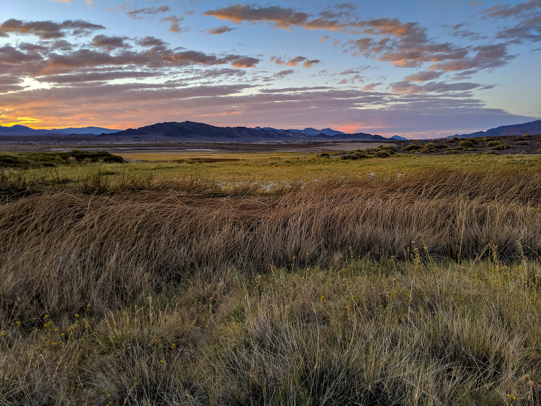
Touring the Amargosa Basin near dusk
The National Conservation Lands include National Monuments and National Conservation Areas, Wilderness and Wilderness Study Areas, Wild and Scenic Rivers, National Scenic and Historic Trails. These nationally significant lands embody freedom, discovery and unique outdoor experiences.
This collection of protected public lands also protects and preserves America’s sacred sites and cultural history. From ancient Puebloan cultures of 1,000 years ago to Spanish, Mexican, Native American and American settler histories from recent centuries, the National Conservation Lands represent a complete tour of the history of the American West. The Old Spanish National Historic Trail passes through the Amargosa Basin, and is a central cultural feature of our area.
Over 600,000 acres of the Amargosa Basin newly protected in September, 2016:
Recently, opportunities have arisen to direct the future management of these areas. The Desert Renewable Energy Conservation Plan (DRECP) is a multi-agency planning effort which seeks to direct renewable energy to certain lands in the California desert while prioritizing conservation on other lands.
Secretary Jewell announced the permanent protection of over 600,000 acres of land in the Amargosa River watershed. These protections will mean that in sum, nearly every acre of this irreplaceable landscape is under conservation.
The Amargosa Basin is a region comprised of numerous valleys which feed into the Amargosa River, the only free flowing river in the Mojave Desert. Rugged multi-colored cliffs, extensive and seemingly barren alkali flats, and deeply incised canyons are tied together by a ribbon of green, abundant life running along the River’s corridor.

Map of the California Desert Conservation Areas
These protections are a part of the Desert Renewable Energy and Conservation Plan (DRECP), a sweeping land-use plan amendment by BLM intended to facilitate renewable energy development while conserving vast swaths of the California desert, some 2.8 million acres in total. These new California Desert National Conservation Lands usher in a remarkable new era of land management in the desert, providing wildlife connectivity and landscape-level conservation.
The DRECP is not the first significant land protection victory in the Amargosa Basin – the California Desert Protection Act of 1994 designated hundreds of thousands of acres of federally managed Wilderness, and in 2009, a 25 mile stretch of the Amargosa River was protected as Wild and Scenic. What makes the DRECP revolutionary, however, is that it is protecting the spaces in between those areas. By tying together the landscape in a contiguous swath of preserved public land, the DRECP will ensure that the integrity of the Amargosa Basin remains intact for future generations.
The designation of the California Desert Conservation Lands in the Amargosa Basin is of particular importance for local businesses in the area. The economies of Death Valley Junction, Shoshone, and Tecopa are entirely reliant on a steady flow of tourists who visit the area for its spectacular scenery and natural wonders. From birdwatchers to hikers to hot spring-ers to OHV enthusiasts, over a million visitors a year pass through the Amargosa Basin, sustaining jobs for local residents and fueling the boom that has seen a 50% increase in local businesses over the past five years.
Click hereto read Amargosa Conservancy’s support for National Conservation Lands in the Draft Environmental Impact Statement for the DRECP.
Some of the Special Places Preserved:

Tecopa Marsh
The extensive network of wetlands surrounding Tecopa, California is one of the most special places to be preserved as California Desert Conservation Lands.
Rainbow over Tecopa Marsh
These rich, groundwater-fed marshes are home to hundreds of migratory and resident bird populations, making them one of the best birdwatching destinations in the entire Southwestern United States. Additionally, the extensive thickets of three-square bulrush are home to the critically endangered Amargosa vole, a small rodent whose population hovered just above extinction-level, until a multi-agency group (including BLM and the Amargosa Conservancy) launched into action to save it. Protection through the DRECP will ensure that the vole’s habitat is preserved forever. “The BLM has taken an important step toward the recovery of the Amargosa vole by permanently protecting its habitat. Our collaborative efforts to save this critically endangered rodent can only succeed if it has a place to live, and the designation of its habitat as California Desert Conservation Lands increases the chances of the vole’s long-term survival,” said UC Davis Professor and vole biologist Dr. Janet Foley.
Silurian Valley
This iconic desert valley south of the Amargosa River became a flashpoint in the debate over industrial-scale renewable energy development…

Silurian Valley
…as a now-jettisoned proposed wind/solar facility there threatened the ecological and cultural integrity of the Amargosa Basin. Silurian Valley features some of the best and most intact cultural remains in the desert, as its dry lake beds once were full of water and the site of extensive paleo-Indian villages.

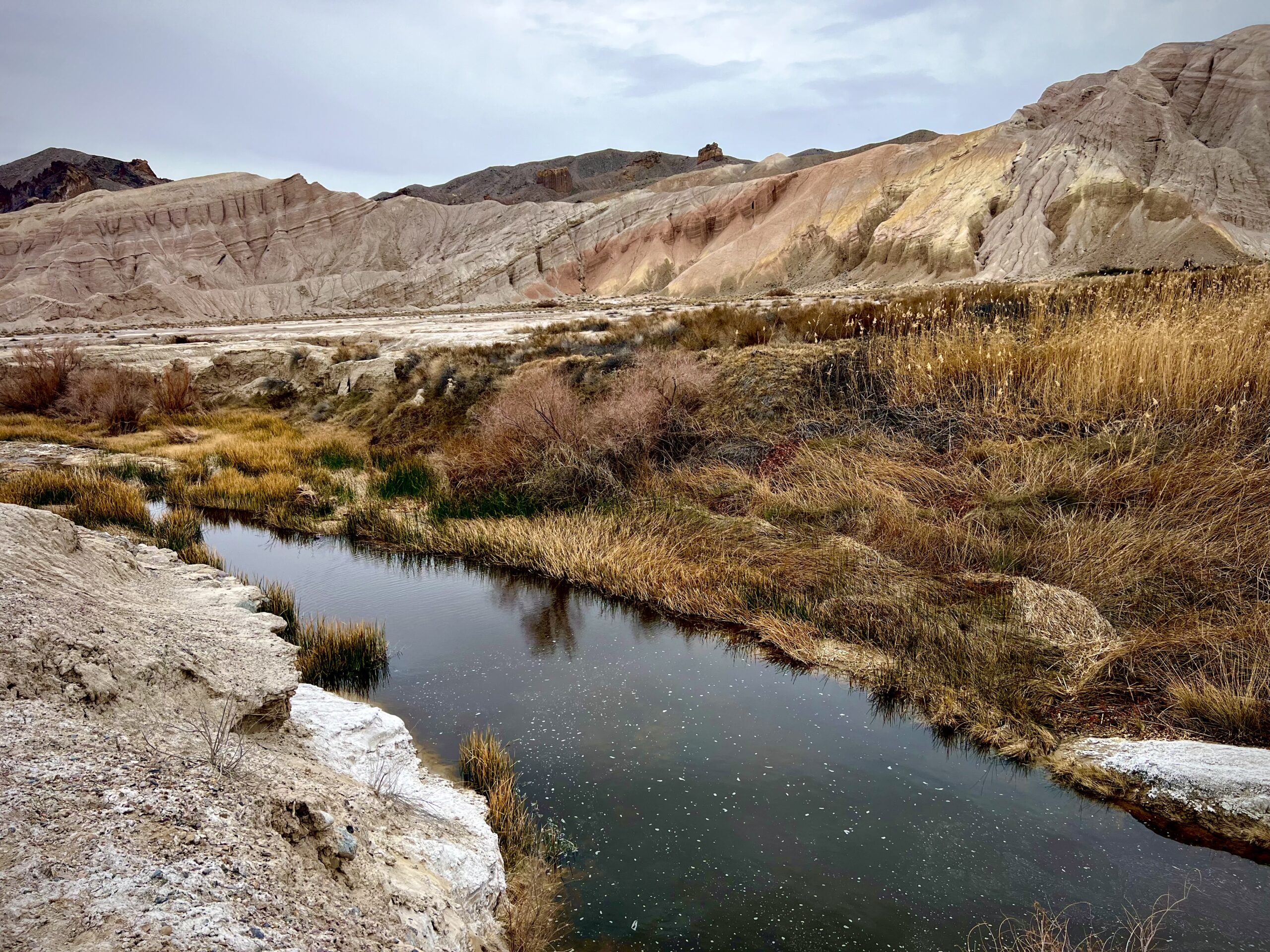
Willow Creek
An unforgettable ribbon of green in one of the most arid places in the world, Willow Creek is perhaps the most important tributary of the Amargosa River. Fed by perennially flowing sweetwater springs, Willow Creek is home to a variety of wildlife, and is a very popular destination for tourists and hikers.
Willow Creek
ABOUT THE FRIENDS GRASSROOTS NETWORK
Conservation starts with community, and history has shown that places are best protected when there is a group of local citizen advocates to lead the effort. As members of the Friends Grassroots Network, we do critical, on-the-ground work to steward and protect the National Conservation Lands. We also use our collective voice as a national network to advance strong conservation management policies and practices. In 2014 the Friends Grassroots Network collectively raised over $2 million to support this work.
From our blog: NATIONAL CONSERVATION LAND
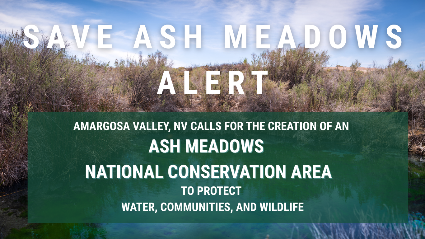
SAVE ASH MEADOWS ALERT — Amargosa Valley, NV calls for creation of Ash Meadows National Conservation Area
Amargosa Valley Calls for Creation of an Ash Meadows National Conservation Area THURS. MARCH 26TH, 2026 -- AMARGOSA VALLEY, NV On Thursday, March 26, the Amargosa Valley Town Board took a historic step toward protecting the lands and waters that sustain their...
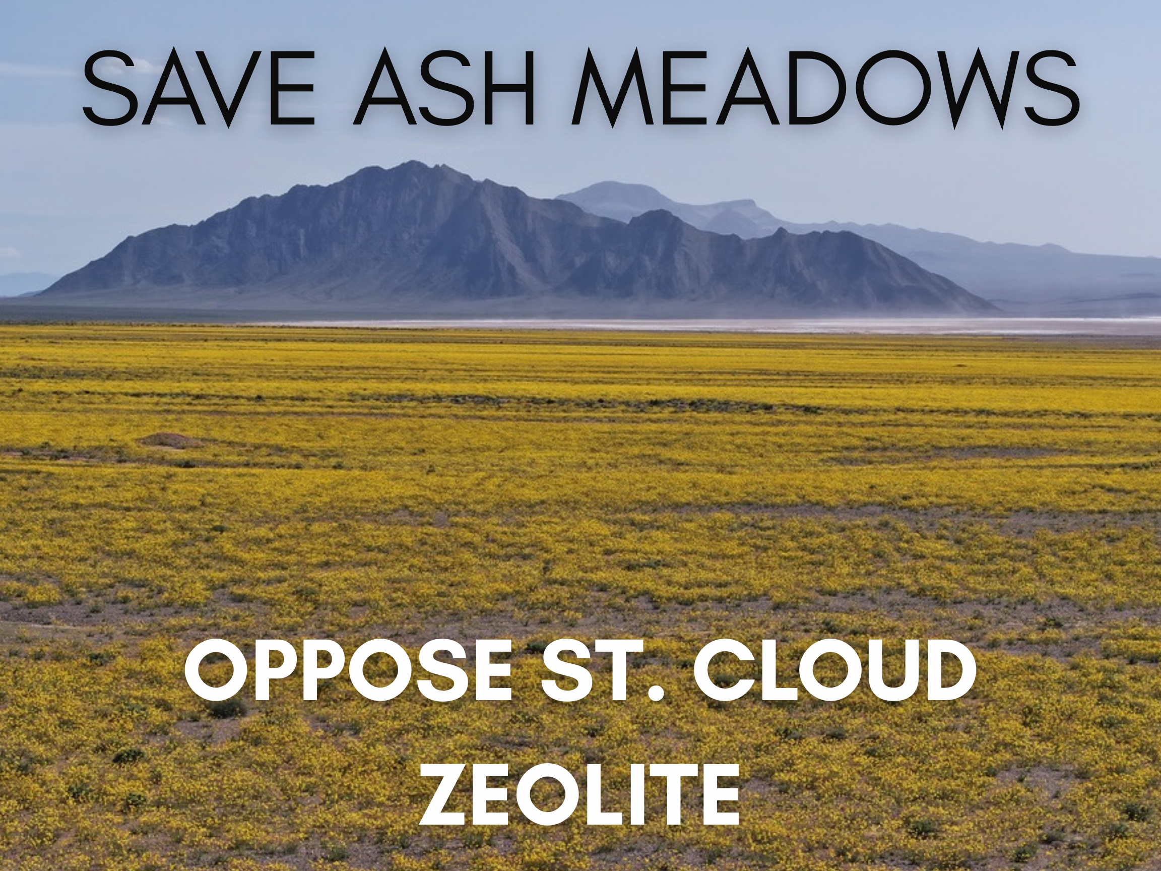
Ash Meadows Threatened Once Again: What’s at Stake with the St. Cloud Mining Project Approval
By Mason Voehl Campaigns Director Amargosa Conservancy Over the past few years, the communities of the Amargosa Basin could not have made themselves any clearer: we will not abide by predatory extraction projects that put Ash Meadows at risk in the name of profit. And...
The BLM’s New Public Lands Rule: New or More of the Same?
By John Hiatt In June of this year the Bureau of Land Management’s “Public Lands Rule”, also known as the Conservation and Landscape Health Rule was finalized, although the procedures and guidance on implementation are still a work in progress. The rule...
A Slow Walk On A Long River
by Josh Jackson If I were to tell you I was going to visit a “wild and scenic river,” what kind of images would that conjure up for you? Perhaps a raging rapids of white water careening through large boulders? Or how about a meandering tributary with deep pools and a...
Executive Director’s Report: The Deep Value of our Remaining Wetlands
by Mason Voehl Executive Director Questions of values are the hardest to answer. I was asked recently to put together a brief presentation describing the key features, resources, and values of the Amargosa Basin. There is a straightforward approach to crafting such a...

What is a “Solar PEIS,” and what does it mean for the future of the Amargosa Basin?
Caption: Palen Solar Project in Riverside, CA; determined as suitable under the DRECP by Chris Clarke Amargosa Conservancy Board Member Ruth Hammett Associate Director, California Desert Program National Parks Conservation Association In December 2022, the Us...