It’s a calm day at Ash Meadows National Wildlife Refuge.
A class of undergraduates from Pomona College has gathered at the Crystal Springs boardwalk to hear hydrologist Andy Zdon introduce his tour of the hydrogeology of the Amargosa River Watershed.
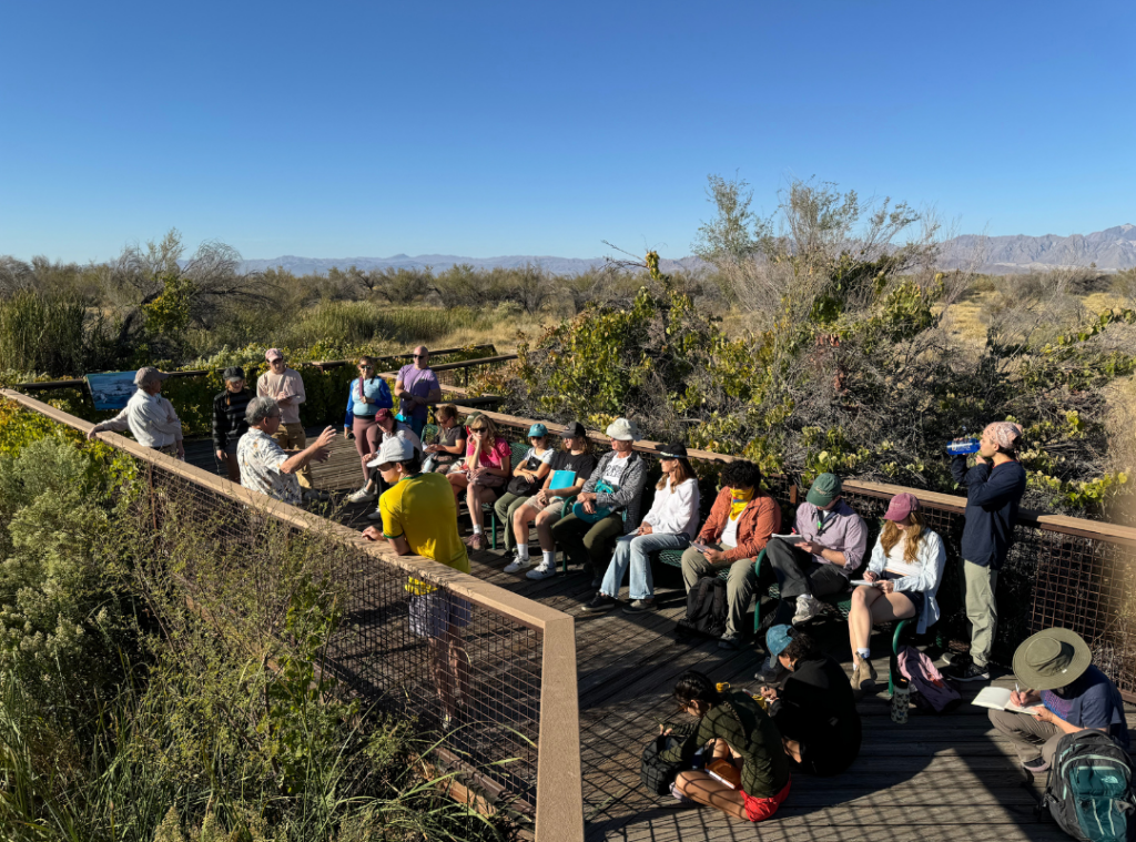
Zdon has been studying the water of the Amargosa for over 15 years, primarily as a consultant to Amargosa Conservancy. His most valuable contribution to our organization has been two State of the Basin Reports (read the most recent SOBR here), which provide a summary and explanation of data collected as part of an ongoing hydrologic monitoring program.
The complexity of this natural water system is nearly incomprehensible to a layperson. Zdon candidly shared that despite decades of studying and modeling, he and other experts still don’t have a complete understanding of the hydrology of this watershed. Groundwater experts working in the region have proposed a handful of differing interpretations of the data and models that exist. So, where to begin?
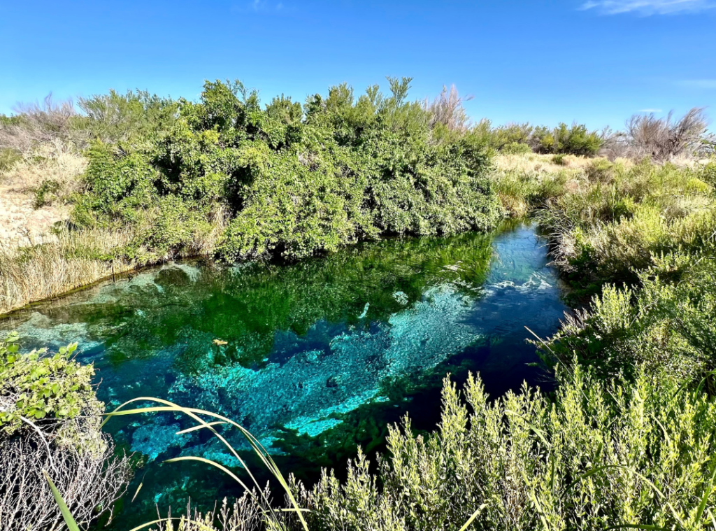
Crystal Spring at Ash Meadows National Wildlife Refuge
Zdon directs the class to observe Crystal Spring for a moment.
The surface of the perfectly clear blue water ripples slightly, though there is no breeze to stir it. Crystal Spring is a hole in the ground where warm groundwater flows directly out of the carbonate aquifer – a layer of limestone and dolomite that transmits water throughout the basin, laterally many miles as well as vertically thousands of feet. The rippling on the water’s surface is caused by this vertical movement as the water rushes upwards and spills out of the ground.
The next stop is Devils Hole, home of the most endangered fish in the world, the famous Devils Hole Pupfish. Tom McHenry, environmental lawyer and instructor of the desert policy class that Zdon is addressing, prompts the students with difficult questions about conservation. Should millions of taxpayer dollars be spent to preserve this tiny animal? Does a fish have rights to water in a court of law? Is it fair for the federal government to restrict a small community’s groundwater pumping to maintain the water level in the Devils Hole for the pupfish? These are questions with no clear answer, the kinds of questions that are critical for us to keep in mind as we carry out advocacy work at Amargosa Conservancy. Effective conservation requires flexibility, since our understanding of natural systems and the ways that human activity affects them is constantly evolving as researchers provide ever deeper insight into the environments we seek to protect. What’s more, ethical standards also change over time. Thoughtful reflection on these tough questions of value and ethics is a crucial part of day-to-day environmental conservation work.
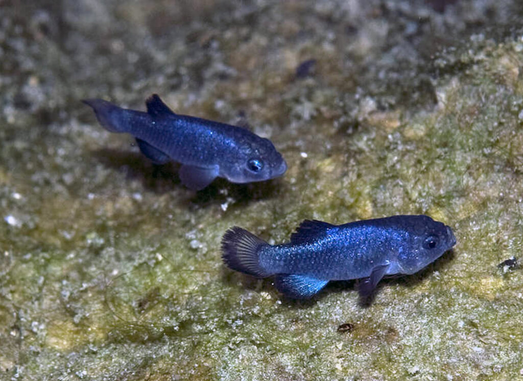
Devils Hole Pupfish (Cyprinodon diabolis)
We follow the Amargosa River downstream from Ash Meadows along one of its “dry” reaches, where the river flows beneath the land surface as groundwater through sand and gravel.
Near Shoshone, California, its water is forced back to the surface when it encounters another aquifer beneath Pleistocene-age Lake Tecopa. We stop at the Borehole Spring, so named because it was created by accident when mineral exploration drillers encountered hot groundwater under so much pressure that it created an uncontrollable artesian flow. This new flow reduced pressure in the surrounding system of hot springs, causing ongoing degradation of habitat as nearby springs went dry. Yet, in an ironic turn of events, the water released by this blunder has developed into a lush marshland that sustains one of exactly two remaining wild populations of the endangered Amargosa Vole. Case in point: human impacts on natural systems can not always be valued on a simple binary scale of “good” or “bad” for the environment.
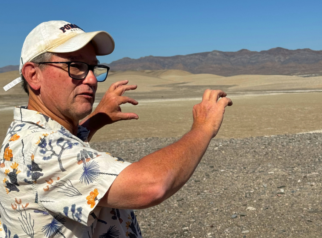
Hydrologist Andy Zdon describes the orientation of the carbonate aquifer that transmits groundwater through the Resting Spring range (seen in the background).
The question of exactly how much water is flowing in the Amargosa River has been surprisingly difficult to define.
Through his work for Amargosa Conservancy, Zdon has found that the established consensus on the sources of the river’s water and the path that its flow takes on its way from Beatty down to Shoshone is not supported by data collected from monitoring wells in the basin. This unexpected conclusion has implications for the management and protection of the river and the aquifer that supports it. A crucial protection included in Wild and Scenic River status granted to a portion of the Amargosa in 2009 is a federally reserved water right for the flow of the river. Understanding the volume of water moving through the Amargosa River, including at the surface, underground, and in the groundwater basins upstream that supply the river, is essential to any effort to manage and protect it. Zdon’s data will be shared with the BLM, who are charged with developing a Comprehensive River Management Plan for the Amargosa.
As Zdon continued the tour, I was enthralled by the complexity and persistent mysteries of Amargosa hydrology. Some students were more compelled by the beauty of the desert and found themselves wandering towards the horizon in contemplative reverie. Anyone who has enjoyed a warm autumn Amargosa day will understand how distracting it can be. Either way, that time was not wasted.
