
A Brief Geologic Tour of the Amargosa Basin
By Amargosa Conservancy board member and secretary, Bill Neill
ORIGIN OF PALEOZOIC CARBONATE STRATA THAT ALLOWS LONG-DISTANCE GROUNDWATER FLOW
By definition, desert areas have little rainfall and natural water sources such as springs and streams are rare. Compared to other parts of the Mojave Desert, the Amargosa region is blessed with numerous springs that nourish a diversity of plants and wildlife, and are supplied in part by groundwater moving from distant recharge areas.
Studies indicate that some natural springs in the Amargosa region are supplied by rain and snow falling on the Spring Mountains, 40 miles to the east. Rock units that convey this subsurface flow are mostly limestone and dolomite layers made permeable by fractures widened by dissolution, similar to the process that creates limestone caverns. This post will explain why permeable sedimentary rock units are widespread in the Amargosa region.
First, some definitions and descriptions. Limestone and dolomite are called carbonates because they contain the element carbon bonded to oxygen. Limestone has the composition of calcite, CaCO3, and is derived from calcium ions and carbon dioxide dissolved in sea water. Calcium carbonate is precipitated inorganically from warm, shallow tropical ocean water, to form calcareous mud in places like the Bahamas and the Great Barrier Reef of Australia; and it forms the shells of many marine organisms such as clams, oysters and coral. As calcareous sediments are buried by overlying deposits, these sediments become lithified into limestone, usually forming tabular layers, such as displayed on the west face of the Resting Spring Range east of Shoshone (Photo 1).
Dolomite is derived from limestone by the partial replacement of calcium atoms by magnesium atoms, and is less soluble than limestone.
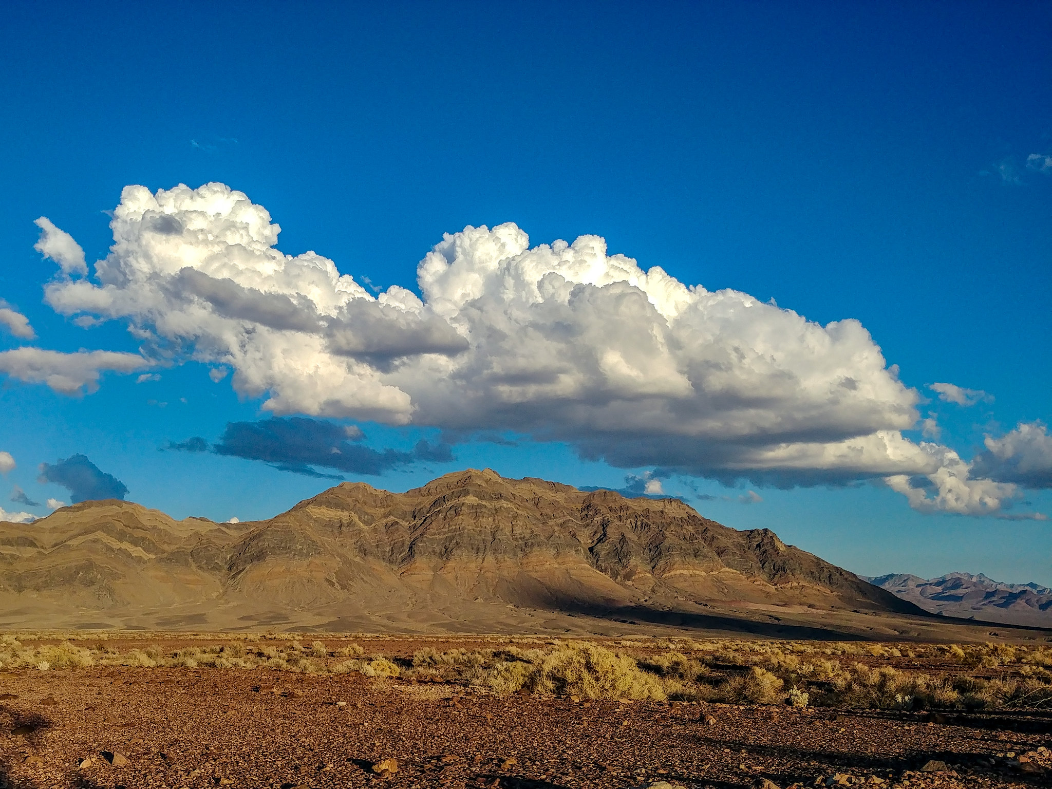
Photo 1: Colored bands on mountain front are mostly tilted tabular carbonate layers of Paleozoic age.
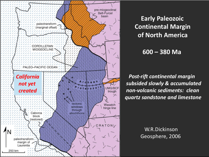
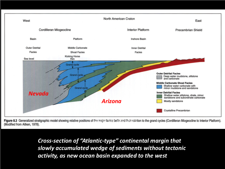
Carbonate strata of Nevada and the Mojave Desert were deposited in shallow tropical sea water mostly during the Paleozoic Era, from 600 to 380 million years ago, when animal life was restricted to the oceans – amphibians and reptiles had not yet evolved. During this period, the western continental margin of North America extended between central California and Idaho; the continental crust of Oregon, Washington and northern California had not been created. The continental margin was formed by earlier rifting of a larger continental area, with the separation of either Australia or Antarctica to form the proto-Pacific Ocean basin. After the rifting event, the continental margin subsided slowly and accumulated a wedge of sediments, much of which was limestone and dolomite.
Thick intervals of Paleozoic limestone in the Mojave Desert are located near the surface at Mitchell Caverns in the Providence Mountains and at limestone quarries for manufacturing cement – near Victorville and Lucerne Valley, and near Las Vegas, where mining is economically feasible. Carbonate layers that originally were level and widespread have been extensively faulted and tilted, but thicknesses are sufficient in the Amargosa region to transmit groundwater over long distances, for which we should be thankful, and vigilant for developments that could disrupt or reduce that flow.
For the full story about regional geology, see “The Broken Land – Adventures in Great Basin Geology”, by Frank L. DeCourten, 2003, University of Utah Press.
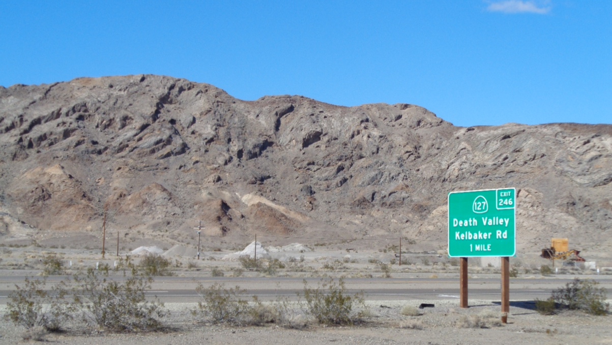 Photo 2: A thick sequence of Paleozoic limestone west of Baker that has been tilted, slightly folded and partly dissolved or eroded in places to form shallow caves.