
The Chaos in the Amargosa
By: Holly Fischer
The first place I hiked in the Amargosa River Basin was the Bill Christian Trail, starting at China Ranch. The morning started with a bevy of quails running in and out of the honey mesquite that lined the parking lot, chirping and whistling as they went. I walked along a creek where tiny fish, the Amargosa speckled dace (Rhinichthys osculus nevadensis), could be spotted if you were lucky.
The trail eventually opened up, and in the distance, I noticed a large mountain that was different from the surrounding rocks. The multi-colored and tilted layers crashed into each other as if they were fighting to be on top. Thin and even-layered sediments framed the wild rocks. These contrasting rock formations suggest two distinct creation events–a time of slow deposition versus fast mass-movement, possibly volcanic and tectonic activity. The drastic distinction between these two mountainous views intrigued my geology-focused brain. I wanted to unravel each layer—to reverse-engineer the mountain to discover what process and events created the final result in front of me.
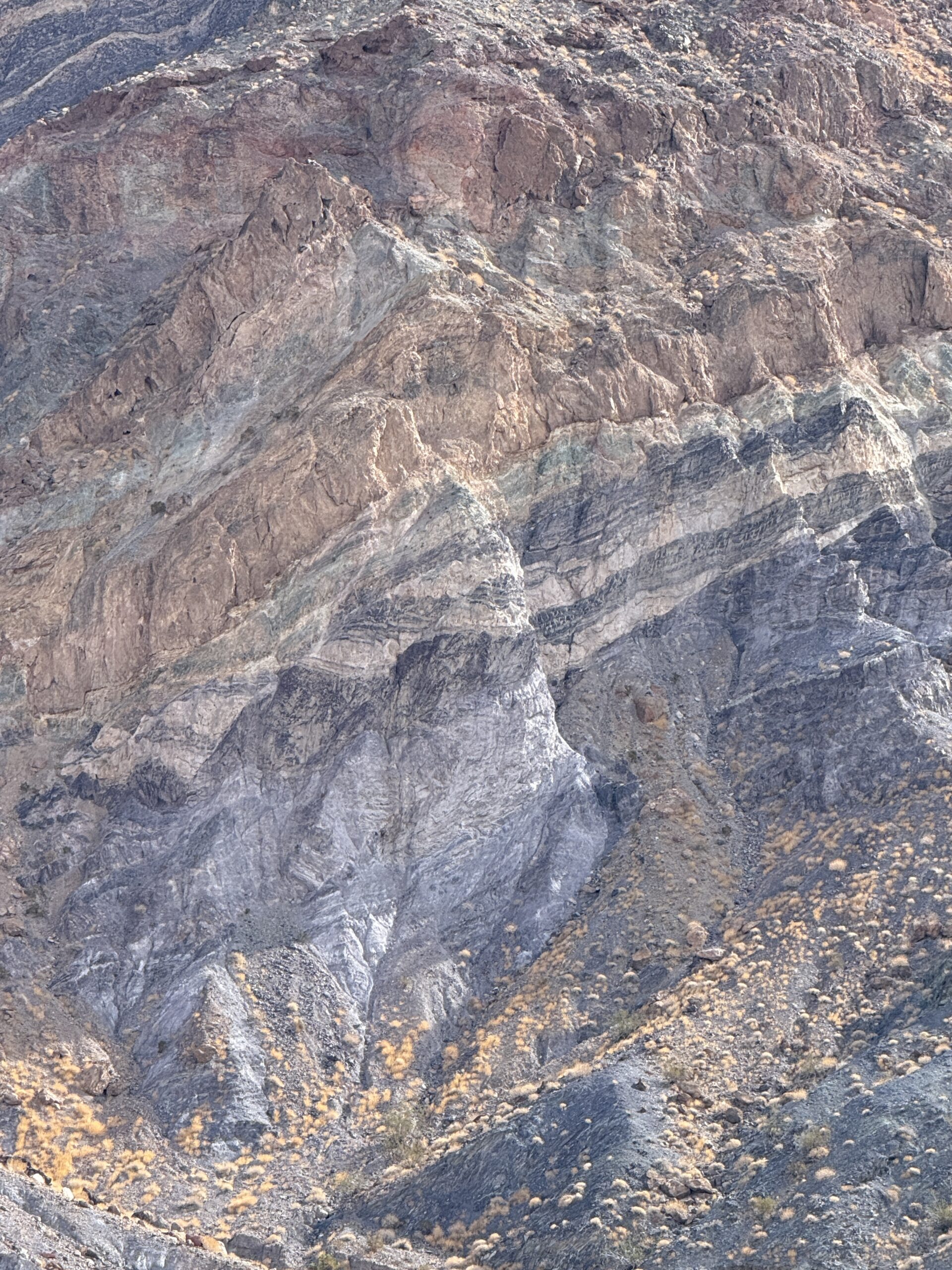
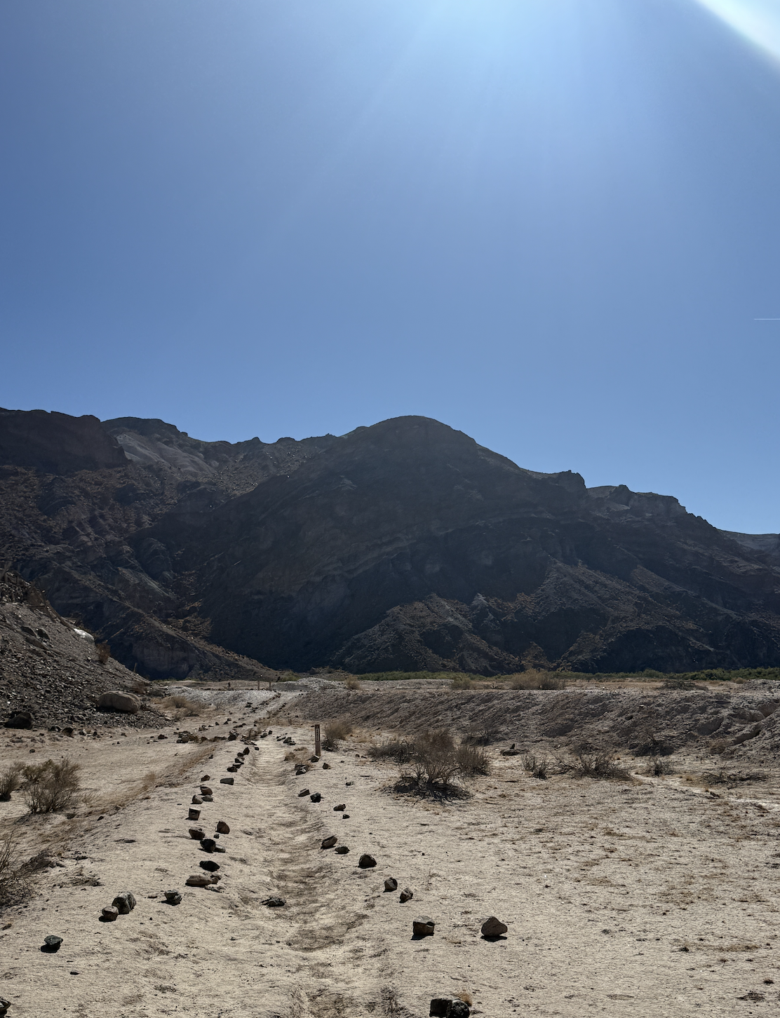
The Amargosa Chaos at China Ranch close-up layers (left) and from the trail looking south at the mountain (right).
My coworker hiking with me told me this area is known as the “Amargosa Chaos,” a fitting name for such a wild interaction of colorful rock layers. My initial thoughts on the formation included volcanic origins. I wondered if a magma plume grew beneath the surface, rising, like bread in an oven, causing the ground above to shift and tilt around its large mass. Or perhaps ancient volcanoes miles and miles away had erupted, causing massive lava flows to layer onto one another like a cake. These layers could have been cut through and overturned by the pressures from the Pacific plate subducting underneath the North American plate on the west coast. I pondered how the volcanics were most likely older, originally buried by the more evenly layered sediments. Years of erosion and uplift revealed the layers, pancaked together, showcasing the history of volcanics.
But all of this is just a guess. What I originally thought was volcanic primarily in nature shifted throughout my reading.
After returning home, I immediately started searching for the “how” of it all. I wanted to know everything. I read about which layers of rock came from what depositional event and how the layers ended up in their final form. Through my Google deep dives and fishing through scientific journals, I learned about Levi Noble.
Known as the pioneer geologist of Death Valley, Noble began his journey in the Amargosa River Basin in 1917. He researched the nitrate deposits in the folded lakebeds from Death Valley to the south of Tecopa and established his field headquarters in Shoshone. In a report sent to the USGS, he described the Amargosa Canyon:
“The gorge of the Amargosa River below Tecopa is one of the weird features of this desolate region, being carved in fantastic forms through peculiarly varied volcanic flow rocks, conglomeratic breccias, and the so-called lakebed sediments.”
In later papers, Noble referred to the Amargosa Chaos as “a mess” and a “chaotically disordered rock structure.” I realized that this geologic feature was a mystery to even the best in the field at the time. Even after submitting his findings and receiving approval from his peers, Noble often voiced concerns that his conclusions were not the full picture.
In his papers, Noble described the three phases of the Amargosa Chaos: Virgin Spring, Calico, and Jubilee, which represent various stages of activity and a wide range of ages. Before this point, my research focused on the Spring Valley phase, which is often referred to as the main chaos. In the maps and descriptions, I stopped and wondered if this was what I saw. The descriptions put the location too far north, and the photos didn’t have the surrounding topography I remembered.
However, when I started reading about the Jubilee phase, everything clicked. What I saw at China Ranch was not the main section of the Amargosa Chaos, but the Jubilee phase at Rainbow Mountain.
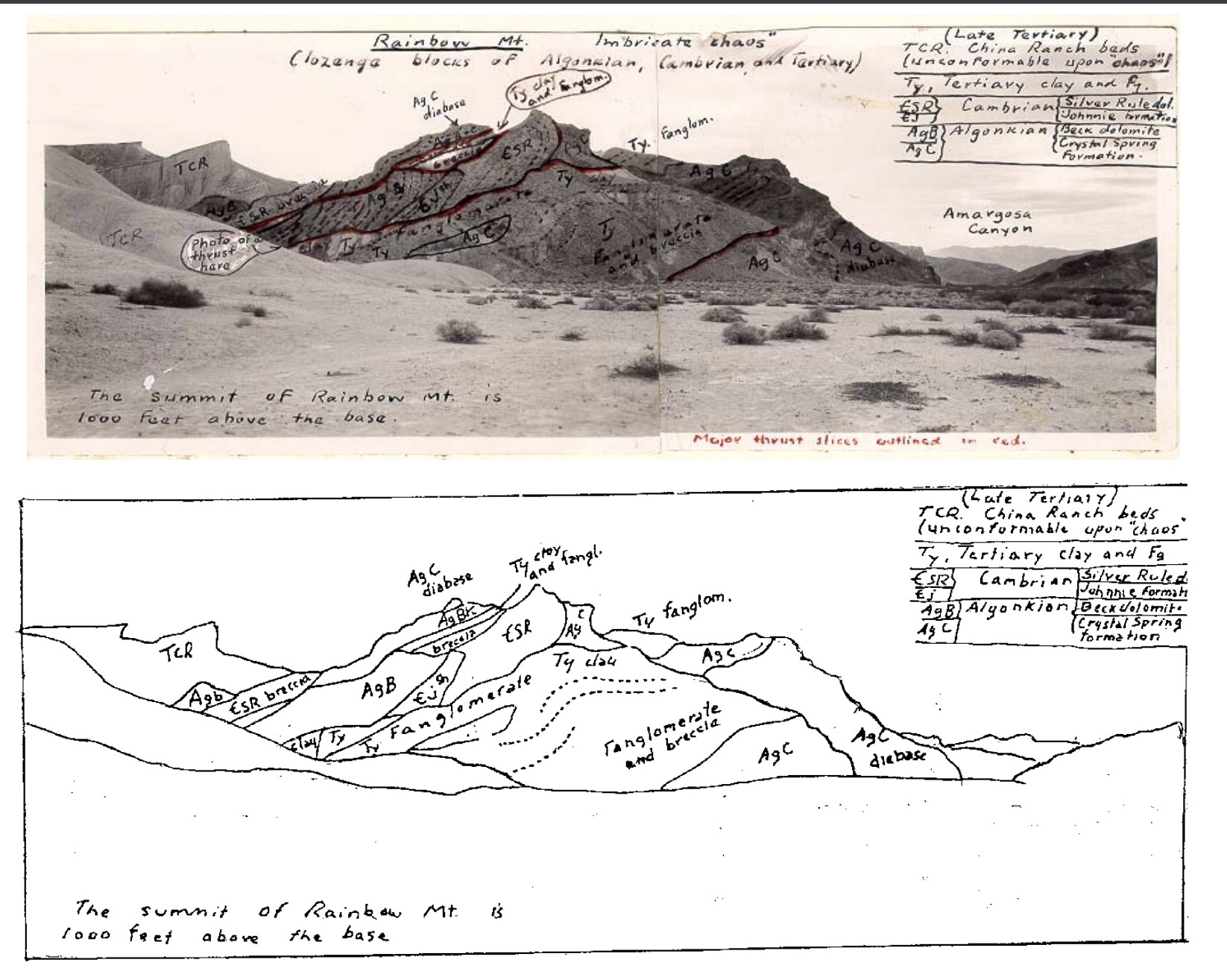
Annotated photo of Rainbow Mountain showcasing the Jubilee phase of the Amargosa Chaos.
I turned to another geologist, Chester Longwell’s 1951 paper “Megabreccia Developed Down-slope From Large Faults.”. Longwell describes how landslides from Arizona moved sediments across Nevada, reaching the Amargosa River Basin’s southern boundary in California. These mass movement events brought an assorted group of sediments— igneous, sedimentary and metamorphic— and mixed them all up during the travel. Clay, silt, sand, gravel, and even boulders tumbled their way across states and settled in a jumbled mess. This “mess” lithified to form breccia–also referred to as megabreccia when the scale of deposition is large enough. In the case of the Armagos Chaos, megabreccia describes this event perfectly.
I left Longwell’s paper with more questions. I am only scratching the surface, and while some questions have been answered, many new questions have appeared. But now I feel an even deeper connection to the Chaos, far beyond its intriguing geological features. I also travelled across states, from North Carolina, driving 34 hours to reach Las Vegas. In my journey to conservation and the Amargosa Conservancy, I have tumbled and picked up elements from my surroundings—from learning how to identify hiking routes and studying plants and soils from the Mojave through the Basin and Range. And now here I sit, a living conglomerate of disparate pieces all stuck together, each having prepared me for the upcoming restoration work that the AC will embark on in 2026. While my journey is not over, I see my experiences laid out like the strata in rock. While chaotic and at times confusing, it leaves a colorful view.