
Snapshots of the Lower Carson Slough
by Morrigan DeVito
Sunrise on the Carson Slough. The salt, saltbushes, saltgrasses are all translucent. The desert holds its breath, waiting for the summer heat to descend when the sun takes its cosmic seat above us all. Pale blue and rose pastels sweep over Eagle Mountain, that lone peak who watches over this land. Small bats flit and flutter, scattering across the horizon, feeding one last time before they must retreat and wait for the day to pass. A nighthawk careens across the road and settles somewhere out on the salt, unseen. Horned larks chatter and shelter deeper into the brushes.
I am just a visitor to the Carson Slough, coming out at least once a month to conduct groundwater monitoring or botanical field work for the Amargosa Conservancy. Situated southwest of Ash Meadows National Wildlife Refuge alongside Bell Vista Road before you reach Death Valley Junction, the Carson Slough is a spring discharge area. To understand what that means, imagine looking down at the Amargosa River Basin from a satellite view. Sometimes called the heart of the Amargosa, Ash Meadows National Wildlife Refuge would light up green as the 24,000-acre area contains at least 50 springs and seeps. The ancient water pushing to the surface supports numerous oases brimming with life, and if you were to follow the scaffolding vein of groundwater southwest and over the NV border, you would reach the Carson Slough– where these veins converge in a network of alkali wetlands.
On the ground, at first glance it may look like nothing could grow here. Salt stretches for miles. But alkali wetlands are characterized by this salt content, and the Carson Slough’s plants are tough. To survive here, they have special adaptations to cope with the high PH of the soil, such as salt-secreting pores on leaves, pale coloration to deflect UV rays, and, perhaps most importantly, roots that reach the vast network of groundwater beneath.
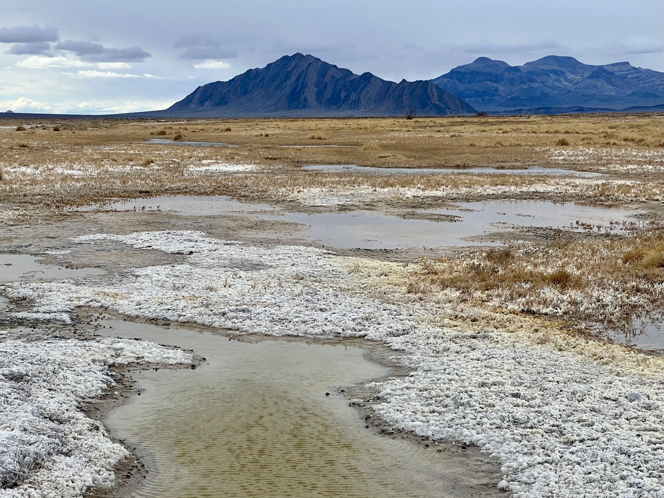 Photo by Mason Voehl
The emblematic plant of this landscape is the Amargosa niterwort (Nitrophila mohavensis), a tiny, endemic perennial that grows about four inches tall. It can only grow where the water table is high enough to reach, and spreads its wide, rhizomatous roots a few feet deep to reach it. When walking out in the Carson Slough, I enter the world of the Amargosa niterwort as sandy and sometimes mud-slick soil turns to thick salt crust crunching beneath my boots. The leafy bodies of the Amargosa niterwort poke out from where the salt is a few inches thick, little dark green blotches against the white.
In ecology, we often talk about indicator species: an organism whose population health tells a story about the health of a landscape. The Amargosa niterwort is one such species, and it has become a rallying point for communicating about the importance of groundwater– a tangible indicator of the water’s health in this landscape. The Amargosa niterwort is listed as endangered under the Endangered Species Act because of its limited range, found only here in the 1,050 acres of critical habitat of the Lower Carson Slough, and in scattered populations around Tecopa.
This summer, I came out with Dr. Naomi Fraga of the California Botanic Garden and her students to monitor the Amargosa niterwort, one of the plant priority species of our Restoration Implementation Grant work received by the state of CA Wildlife Conservation Board. We ventured into the lower Carson Slough to count and document the Amargosa niterwort population, waking up well before sunrise and driving out from Shoshone to get our work done before 10 a.m when the heat really descends. While out here, we count and measure the population in transect squares. Some squares may have over a hundred niterwort, others zero. Because this plant is rhizomatous, it moves around each year as it produces new growth, making yearly documentation an important neccesity to monitor its health.
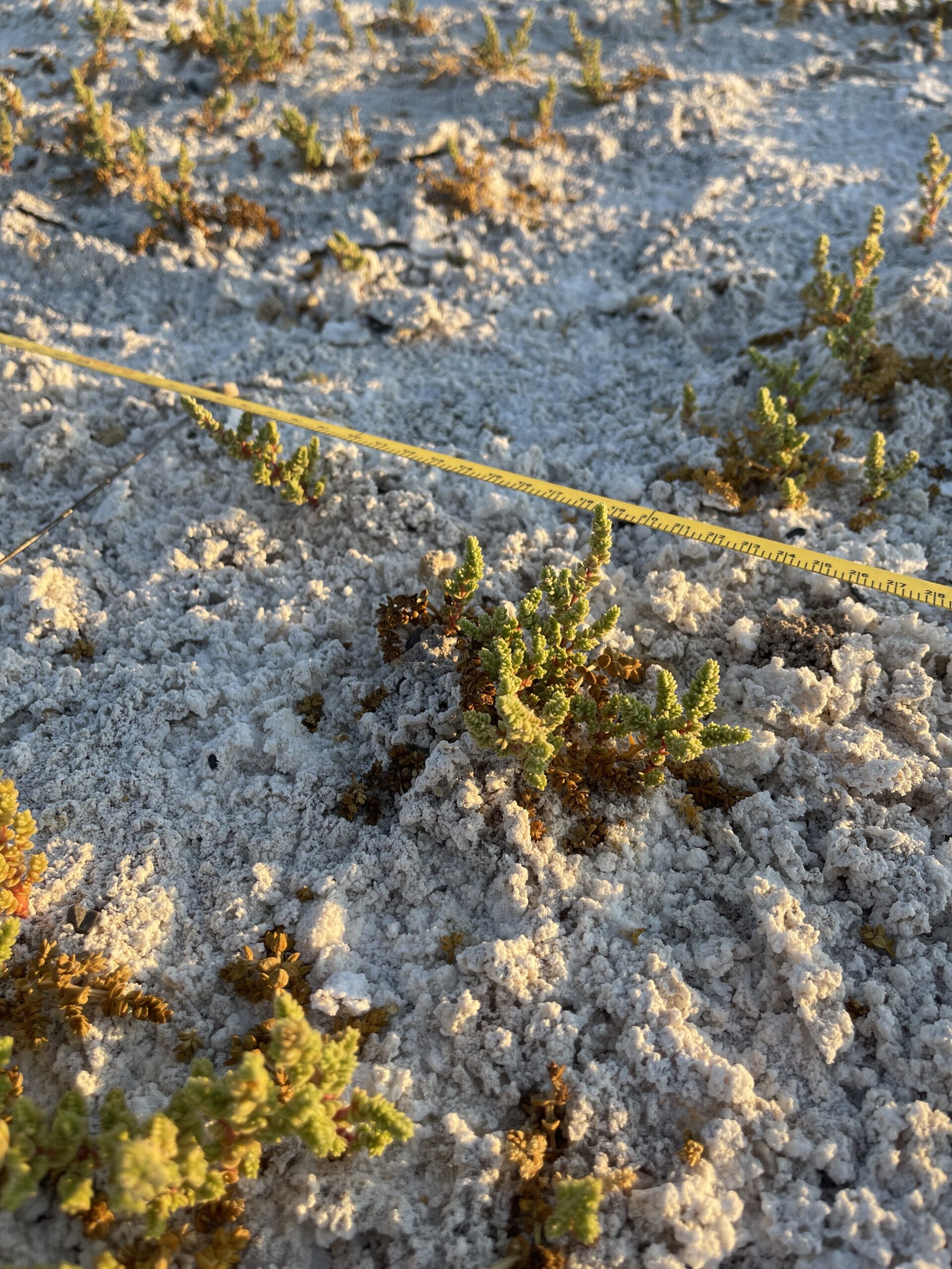 Photo by Naomi Fraga
Are we simply torturing ourselves doing this work in the summer? Not quite. Like many alkali wetland plants, the Amargosa niterwort grows most abundantly at the peak of summertime. When you enter this micro-universe you begin to notice things you would have overlooked. The waxy green leaves on the niterwort are paddle-shaped, the stems sometimes a deep red hue. Some of the niterwort have thin cobwebs on their leaves, perhaps from a tiny type of spider mite, unseen to our naked eyes. But like much of the niterwort’s life history, there is a lot we don’t know.
What we do know is that it is intricately connected to the groundwater in the Carson Slough. And that’s why once a month, I come out and collect data from 11 piezometers– an instrument that measures groundwater depth. This information is building off of years of records kept by the Amargosa Conservancy, and right now this work is the focal point of our restoration program because of the connection between water and Amargosa niterwort. When I come out, I bring a tape measure and crunch through the salt to reach these piezometers, short, sun-bleached plastic tubes that camouflage into the salt. I drop the measuring tape in the tube, waiting for it to buzz loudly and pierce the desert quiet when it touches water. Typically, the water depth is somewhere between 4-6 feet.
This data will be extremely important in the uncertain future. Threats to water and wildlife in the Amargosa Desert and around Carson Slough continue to mount. Most recently, a proposal to conduct exploratory drilling by St. Cloud Mining was recently approved by the Bureau of Land Management, despite the potential for this project to impact groundwater resources and degrade critical habitat for the Amargosa niterwort. Though resilient in the face of adversity, the unvarnished truth is that the niterwort and all other forms of life along the course of the Amargosa River will go as the water goes.
I am grateful to do my small part in establishing the scientific baseline necessary to help Amargosa Conservancy and its allies defend this special place and this hardy little plant from the perils of extraction.
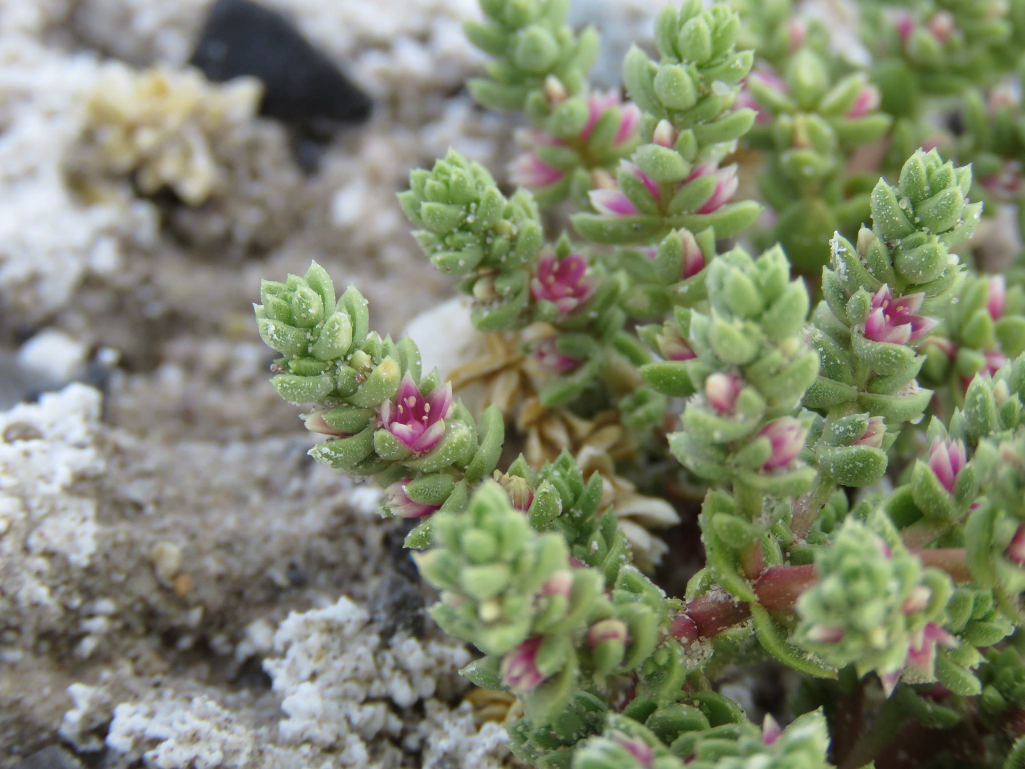
Photo by Naomi Fraga